

Klamath Tour with Water Education Foundation
- Amber Jamieson

- Sep 16, 2025
- 12 min read
Updated: Sep 18, 2025
This tour was provided by Water Education Foundation (WEF), a small nonprofit that strives to provide impartial educational experiences about water issues in California. Nick Gray, WEF Programs Director, greeted us, provided us with our itinerary, and plenty of humor, which kept us all in good spirits as 40 of us piled onto the tour bus to begin our journey down the Klamath River.

Day 1
As we embarked on Day 1 of our journey through the Klamath River Basin, we began at the very top in the headwaters. Dr. Bill Hirt, Professor of Geology at College of the Siskiyous, provided a fascinating overview of the region’s geologic history. He explained how ancient volcanic activity, tectonic plate shifts, and glacial movement shaped the Upper Basin’s unique landscape of fault-block mountains, lava plateaus, and fertile lakebeds. The basin’s physical formation laid the groundwork for the vast wetlands and interconnected lakes that once dominated this area, ecosystems that are now dramatically altered by over a century of irrigation development and water diversions. Understanding this geologic foundation set the stage for deeper conversations about land use, restoration, and water rights that would follow in the days ahead.

Our first stop was at the headwaters of the Wood River, where cold spring water bubbles out from under a rock, a place sacred to the Klamath Tribes.
Shahnie Rich, Environmental Scientist, Klamath Tribes, explained the history and cultural significance of this sacred site, as well as the nearby wetlands they relied on since time immemorial. She explained how these places were the supermarket for her ancestors. A culturally important aquatic plant called “wokas” grows in the wetlands and is used for its seeds, which can be popped like popcorn, dried, or ground into flour.

The Klamath Tribes have a deep cultural connection to the wokas plant, but its habitat in healthy, shallow wetlands has been declining due to wetland drainage and agricultural runoff, threatening the plant's availability and safety as a food source. Klamath Tribes have been collaborating with USFWS, farmers, and stakeholders to restore the landscape and develop functional wetlands so they can restore cultural practices.
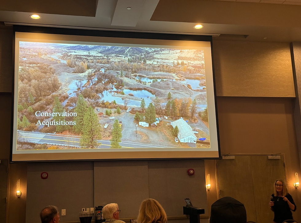
Our next stop was the Klamath Wildlife Refuge, where we met with John Vradenburg, Supervisory Biologist, Klamath Basin National Wildlife Refuge Complex, who explained the role of refuge wetlands in regional ecosystems and water supply.

We met at the Agency-Barnes wetlands restoration project, where they have contracted with the Yurok Tribe to restore the wildlife refuge.
Just last year, the wetlands were de-watered due to water management policy decisions (which do not recognize the refuge as a purpose of the Klamath Project), and in 2024, 200,000 birds died. After just one year of water, the site was teaming with wildlife and birds nesting and seeking refuge along the Pacific flyway.

The Agency Lake and Barnes Ranch areas were purchased by the U.S. Fish and Wildlife Service in the early 2000s to reconnect and restore over 10,000 acres of historic lake fringe wetlands. The Yurok Tribe has become a key partner in this restoration work, demonstrating co-management models that integrate cultural knowledge with science-based habitat restoration. These areas provide essential stopover habitat for millions of migratory birds on the Pacific Flyway and can serve as water sinks to improve water quality and store spring flows for dry seasons.
We stopped for lunch at Putnams Point, where we met Gene Souza, Executive Director, Klamath Irrigation District, and Elizabeth Nielsen, Executive Director, Klamath Water Users Association, who provided an overview of the Klamath Project and an introduction to the Klamath Water Users Association.
They shared the history of the upper basin from the perspective of farmers who have been farming for generations and struggling to seek water security so they can pass on a farming legacy to future generations.

We had lunch as we overlooked the reef seen here, which was one of two basalt rock formations that once controlled the natural water level in Upper Klamath Lake until it was destroyed and replaced with the Link River Dam.
Next stop was the A-Canal, the main canal that starts just above the Link River Dam. There are about 728 miles of drainage canals in the Klamath Project, which have transformed wetlands into farmland. The canals transport irrigation water in the Upper Klamath Basin, which was once a giant lake. There are two tunnels. The "A" Canal has an underground section as it flows through Klamath Falls and the Tule Lake Tunnel. The Anderson-Rose Diversion Dam (formerly Lower Lost River Diversion Dam) diverts water to irrigate farmland in the former footprint of Tule Lake.


Next, we met with Marc Staunton at the Staunton Farms potato field & Tule Lake National Wildlife Refuge, where he showed us his organic potato field, where they grow organic specialty potatoes.

Marc explained to us how his family has made a voluntary agreement with the national wildlife refuge to create habitat and wildlife wetlands on his fields for a period of 2 years, the field is then farmed for four years and has much better production, lower inputs, little to no disease or pests, and creates wetlands, a mutually beneficial agreement that not only provides habit, but also provides productive farms.
Voluntary programs like the Walking Wetlands, where farmers rotate crop fields with wetland fallows, have become a successful model in the Tule Lake region. These programs improve soil health, reduce pests and disease, and restore temporary wetland habitat. Despite these innovations, Tule Lake itself, once a vast natural wetland, is now largely dry due to diking and pumping, with restoration efforts focused on balancing wetland recovery, migratory bird refuge needs, and private land use.

At our next stop, we met with Modoc Nation tribal representatives Ken Sandusky, Homelands Director, and Brian Herbert, Homelands Manager. They shared with us their efforts to purchase and reclaim traditional lands adjacent to Tule Lake and restore upland sage-steppe and wetland habitats. The Modoc Nation’s efforts to restore upland habitat are critical, as these ecosystems support native bunchgrasses, medicinal plants, and wildlife species like sage grouse and were once home to big horned sheep. They are also culturally important landscapes for gathering, hunting, and ceremony. Restoration goals include reversing invasive species spread, mitigating fire risk, and reconnecting fragmented habitats.

Our last stop was with Scott White, General Manager of Klamath Drainage District, who is working to create resilient wetlands in conjunction with sustainable agriculture. He showed us a small-scale model of the fish screens that will be installed in the drainage canals to allow for salmon to return to the Upper Klamath Basin. The model fish screen shown on the table is 1/16 of the size of the actual screens that will be used.
Finally we returned back to the lodge for dinner as John Bezdek, Shareholder, Water & Power Law Group shared with us the behind the scenes work within the federal government for Klamath Dam removal negotiations, which were spurred by irrigators protesting curtailments and staging the 2001 “Bucket Brigade” at the A Canal in Klamath Falls, followed by the Bush Administration reducing instream flows down the Klamath River mainstem the following year. These low flows led to the 2002 fish kill, where it was estimated that over 80,000 adult salmon perished from low flows, warm water, and disease outbreaks in the Lower Klamath River.

Historically, the Upper Klamath Basin contained over 350,000 acres of lakes, marshes, and wetlands—interconnected through seasonal floodplains. Upper Klamath Lake itself was once far larger and connected to extensive seasonal marshlands like Lower Klamath and Tule Lake. Following the 1905 Reclamation Act, the U.S. Bureau of Reclamation initiated the Klamath Project, which systematically drained much of this wetland complex for agriculture through a network of canals, pumps, levees, and diversion dams. Over 75% of the basin’s historic wetlands were lost to this transformation.
Today, roughly 200,000 acres of farmland in the Project area rely on this irrigation system. However, the system no longer reflects modern ecological priorities or Tribal water rights. Water from Upper Klamath Lake, the Lost River, and other sources is now divided among agricultural demand, refuge habitat, and downstream flows necessary for ESA-listed fish. This over-allocation has led to regular and often contentious curtailments, placing farmers, Tribes, and wildlife in conflict during drought years.
Day 2
On the way to former Klamath dam sights, we stopped along the Applegate Trail in the high Cascades at Tub Springs to stretch our legs and check out the artesian well.

Historically, native peoples had seasonal camps in this area, and some of the first emigrants recorded as having traversed this trail were in 1846.
As we approached the former site of Iron Gate Dam, we were joined by Dave Coffman
Operations Director, Resource Environmental Solutions (RES). Dave talked about the decade-plus of scientific studies and years of restoration that started in January 2023, and culminated with dam removal and a free-flowing Klamath River today. Because the federal government would not accept liability for dam removal, KRRC was created to assume responsibility for risks associated with the project to remove dams and restore anadromous fish habitat.
The total project budget for dam removal and restoration was $450 million, but due to increased costs of materials, the budget increased to $495 million and took 4 months to remove JC Boyle, Iron Gate, Copco 1 and Copco 2 dams. Restoration and revegetation work is still ongoing, and we were able to visit a site where heavy equipment is still removing sediment from waterways.


At the former dam site, we also met with Alex Corum, Karuk Tribe Fisheries Biologist. Alex discussed fisheries monitoring and efforts to tag and monitor salmon to identify where the salmon are ending up, noting they have been detected in Spencer Creek, the Klamath River mainstream in Oregon, and the furthest upstream was the Keno fish ladder, which was captured by drone footage.
We then headed to Horse Creek, where the creek had been rerouted from a meandering floodplain to a channelized stream bed on one side of the valley. The Karuk Tribe has been working with landowners to develop off-channel rearing ponds for juvenile coho salmon. The juvenile salmon are tagged with radio, telemetry chips, and remote sensors. All over the basin can track the fish throughout its lifecycle, showing where the fish migrate at different points in time.

Ryan Walker from Siskiyou Farm Bureau and Lauren Sweeney from Scott Valley Agriculture Water Alliance joined us for dinner and discussed the unique challenges of the Scott and Shasta Rivers, highlighting projects that aim to address legacy impacts affecting the Scott and Shasta Rivers, which are the focus of current efforts to establish minimum instream flows. We discussed ideas such as reducing demands on water by building value-added industries, such as a mill that could produce fish-friendly flour that could be owned and operated by the tribes to draw additional economic value from the wholesale crops that are typically shipped out unprocessed.
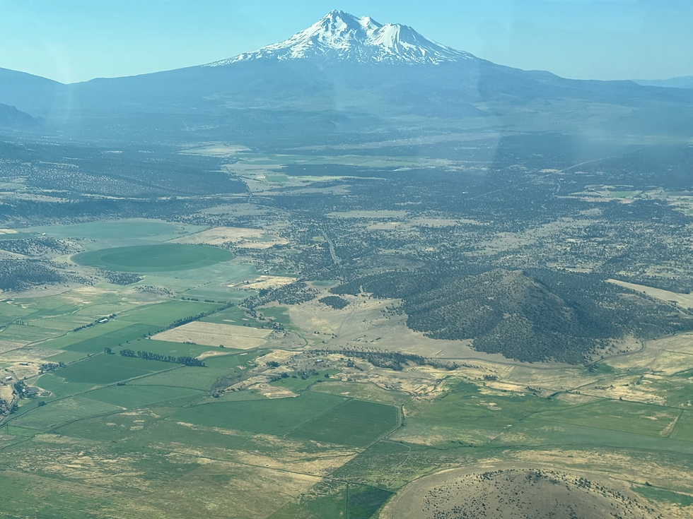
Scott River challenges include a channelized riverbed and a mile of legacy mining tailing piles (see photo below from EcoFlight tour in June of this year) along the river, causing sediment that buries the water table. Water use and demand, particularly diversions and groundwater pumping, have likely increased in certain parts, especially during dry periods. Meanwhile, base flows appear to have declined, which suggests that water extraction (plus water year variations, land use, and reduced recharge) has outpaced natural replenishment in some seasons.

The Shasta River winds through the valley but is heavily modified and lacks riparian vegetation. Historically fed by cold, nutrient-rich snowmelt springs critical for juvenile salmon rearing, these flows are now significantly diverted for agricultural use. In their place, the river receives warmer tailwater and stagnant effluent from Dwinnell Dam Reservoir, resulting in degraded water quality and high summer temperatures that are lethal to salmonids. While Dwinnell once functioned as a key water storage facility, it now acts more as a barrier to natural flow and thermal regulation. As a result, the Shasta River often suffers from low dissolved oxygen, thermal stress, and flow depletion during key fish migration windows. A feasibility study is currently underway to assess the potential for diverting water from the mainstem Klamath River to the Shasta, with the goal of improving cold water inputs, flow reliability, and fisheries recovery.
(The photo of Dwinnell Reservoir below was taken on an EcoFlight Tour in June of this year)

Day 3
Charnna Gilmore, Director of the Scott River Watershed Council, kicked off our morning with a presentation highlighting the Scott River Recovery Action Partnership Project (SRRAPP), where local watershed leaders are working to restore ecological flow and habitat at the landscape scale. Through hydrologic modeling, sediment and channel restoration, and water rights acquisition, SRRAPP is prioritizing restoration efforts, landowner engagement, and economic analyses so that permanent in-stream flows, groundwater recharge, and viable agricultural livelihoods can all thrive together. She highlighted efforts to remove legacy mining impacts that have left over a mile of tailing piles along the Scott River, which are a constant sediment source in the river.

From Yreka, our tour bus headed down the Shasta River canyon to meet Sonny Mitchell, Karuk Fisheries Technician. A we meandered downriver, we could see fire scars, sediment plumes from upslope fires followed by torrential rains that washed out entire watersheds, legacy tailing piles from mining, bulldozed firelines along the ridge tops, many homes that had burned, leaving only chimneys, and eventually stopped in the footprint of the Dillon Fire. Sonny showed us an area where the fire was still smoking, and we talked about historic logging operations that transformed mixed hardwood forests the Karuk people relied on for gathering acorns into even-aged fir plantations that are densely packed and more prone to high-intensity fires.

We learned about the Western Klamath Restoration Partnership, which is a collaborative of tribes, nonprofits, and the Forest Service that works together to identify culturally important areas, develop forest treatments, prescribe low-intensity “good fire,” and manage for ecologically and culturally significant resources such as acorns, bear grass, old growth, and rare or endemic species.
When we arrived at Sandy Bar, Sonny showed us off-channel rearing ponds adjacent to the Klamath River where beaver dam analogs have been built to store water and create habitat for juvenile salmonids to fatten up during low flows, and when the water levels increase during high flow months, the juvenile fish migrate out to the ocean.
At the mouth of the Klamath River, we were warmly welcomed by Ancestral Guard members Sammy and Jon‑Luke Gensaw and Bella, who shared stories of Yurok history and resilience while preparing a traditional meal of salmon cooked on redwood sticks over an open fire.

Through the immersive Redwood Yurok Canoe Tours, we experienced the Tribe’s profound relationship with the river and learned what it means to be truly “one with the water.”
We discussed the devastating legacy of settler colonialism on the Klamath’s once-abundant salmon runs. Massive canneries on the lower river processed millions of pounds of fish, dams like Iron Gate and Copco blocked over 300 miles of upstream habitat, and federal agents in riot gear once arrested and brutalized Yurok fishers for practicing subsistence harvesting on their ancestral land.

Former Yurok Tribal Chairwoman Susan Masten joined us to explain some history and recounted how her uncle’s 1973 U.S. Supreme Court case, Mattz v. Arnett, restored federally reserved fishing rights that had been suppressed for generations. Susan discussed laws that legalized the enslavement of Native people, where settlers could arrest Native people for vagrancy or loitering, and place them into indentured servitude that stripped them of freedom and rights, especially children. These laws, alongside forced boarding school assimilation, devastated Indigenous families and were part of a broader campaign to erase Native identity and occupy their land.
Loss of access to salmon and traditional foods, coupled with the fact that there is not a grocery store on the Yurok Reservation, contributes to alarmingly high rates of diabetes, obesity, and heart disease. In 2016, the Yurok Tribe declared a state of emergency after seven suicides occurred within 18 months, a suicide rate 14 times the national average at the time, deeply tied to cultural disconnection, closure of commercial fishing, food insecurity, and environmental injustice.
Day 4
On Friday morning, Sammy took us to Requa, near the mouth of the Klamath River, a site that remains sacred to the Yurok people and is still used today for subsistence fishing and cultural ceremonies. There, we learned about the First Salmon Ceremony, a traditional Yurok practice that took place until colonization in the 1800s, honoring the return of Chinook salmon each year. When the first salmon of the season is speared, the Yurok medicine man prepares and cures it in a smokehouse. For ten days, they offer prayers of thanks, honoring the salmon as a relative and thanking it for sustaining the people.

During this period, no additional salmon are taken, allowing the initial pulse of fish to migrate upstream undisturbed. Once the ceremony concludes, small portions of the cured salmon are carried upriver to other villages, sharing both the food and the blessing with communities all the way to the headwaters. This sacred practice not only reinforced spiritual connection and intertribal reciprocity but it also reflects a traditional form of fisheries management, ensuring early-run salmon can reach upstream spawning grounds and sustain future generations.
As we stood at the mouth of the Klamath River, watching a sea lion feast on a massive salmon beneath a sky of circling gulls, we were reminded of the raw beauty and complexity of this ecosystem, the deep interdependence between people, water, and wildlife. Meeting Yurok fishermen tending their nets at the river’s edge, and hearing Sammy Gensaw speak about reciprocity, bringing salmon upriver to share with farmers, cooking fish and potatoes side-by-side on redwood sticks at football games, was a profound closing moment. It reflected the heart of what this journey was about: listening, learning, and forging human connection across a watershed shaped by both conflict and cooperation.
Over the course of the tour, we heard from Tribal leaders, irrigators, farmers, biologists, agency staff, and community advocates. Each brought unique insights and deeply held values. While perspectives sometimes diverged, all shared a commitment to the land and a desire to see this watershed and its communities thrive. As we departed, we carried with us not only a deeper understanding of the Klamath’s history and hydrology but a renewed sense of responsibility to participate in shaping its future.


Comments