

Westside Community Meeting in Orleans September 11th
- Sep 7, 2015
- 3 min read

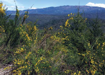
This Friday, concerned community members will be meeting to discuss impacts of the Westside project on our communities. In the coming days, the Klamath National Forest plans to auction off 14 timber sales, that have been analyzed as part of the Westside post-fire logging project, a large commercial salvage logging proposal that covers over 30,000 acres of management including logging on about 10,000 acres of forests affected by the Whites, Beaver and Happy Camp fires of 2014. Areas proposed for logging are adjacent to wilderness areas, the Pacific Crest Trail, within Wild and Scenic River corridors, critical habitat for coho salmon and northern spotted owls and wildlife corridors that are important for providing linkages between the islands of protected areas. The timber sales proposed in the Westside project are all located within the blue circle on the map (below). The Klamath National Forest has not yet released the Record of Decision, which was expected this week, and has not completed formal consultation with the U.S. Fish and Wildlife Service or National Marine Fisheries Service. The Klamath National Forest has not yet received a water quality permit from the North Coast Regional Water Quality Control Board.
Over the past year, our staff has read and commented on the Westside Environmental Impact Statement and attended the informational meetings put forward by the Klamath National Forest, and we have all agreed that the information and format that has been provided is less than helpful.
In order to better understand the landscape that will be affected by the proposed Westside Project, we have used the shape files for the project boundaries to illustrate aerial images from google earth. These maps more accurately depict the scale, magnitude and context of the proposed project by showing the project in relation to the watersheds that are at stake. These maps will be available at the community meeting.
The Karuk Alternative maps that were developed by the Karuk Tribe have proposed to reduce the project scope to focus on strategic ridge-top fuel breaks to protect rural communities so that fire can be reintroduced to the landscape. The Karuk Alternative is a third of the scale of the Klamath National Forest’s proposal.
Since the beginning of time, fire has shaped the landscape of the region, and it is well documented that cultural burning was used to thin the understory, and allow for healthy larger trees to thrive. prescribed fires were also used to encourage the growth of important resources such as acorns and bear grass, which is used by local tribes to make baskets. Over the last century, these mountains have endured the ecologically damaging practices of clear-cut logging, fire suppression, and plantation forestry, which shape most of the landscape we see today. If you live in or visit the Klamath-Siskiyou mountains and observe your surroundings, you have probably noticed the vicious cycle of:

1. clear-cut logging of the big old fire-resistant, shade-producing trees;
2. plantations that quickly become brush fields due to lack of funds to maintain them in an ongoing way;
3. fire suppression policy that continually increases the size and severity of fires that get away;
4. fire-fighting strategies that increase the size of the burned area; and
5. salvage sales that cost taxpayers more than the government makes on the sale, and in many cases leave huge amounts of slash on the ground, setting us up for the next fire. (And setting the fish up for a hot, sediment-choked, disease-prone environment.)
If you would like to learn about the size, scope and specifics of the Westside salvage sale and discuss potential consequences and community responses, you are cordially invited to come to this important informational meeting for Westside post-fire logging project on Friday, September 11, 2015 at 6:30 pm at the Karuk DNR-Department of Natural Resources Community Room, 39051 Highway 96. In Orleans, CA. All are welcome. Refreshments and dinner included, but bring a potluck dish to share if you can.
DIRECTIONS: Headed northeast on Highway 96, go one quarter mile past Orleans and cross the bridge over the Klamath. The parking lot is on the right hand side (Just after Red Cap Road). Cell phones and GPS Navigation systems do not work here, so you may want to map your route in advance. Allow ~2 hours of drive time from Arcata area.
RESOURCES:
Google Earth image maps with timber sale boundaries – Organized by timber sale and/or watershed.
Westside Fact Sheet and Agency Contacts for Westside Project – 1 page fact sheet for letter writing.
EPIC Guide to Groundtruthing trifold – An excellent guide for analyzing project impacts in the field.
The Westside Story – An in epic analysis of the wildlife, wild rivers, and wild places that would be affected by the Westside project.
Final Comments on Westside DEIS – EPIC, Klamath Forest Alliance and KS Wild comments on the Westside Draft Environmental Impact Statement.
The Westside Final Environmental Impact Statement – A link to all of the Klamath National Forest’s documents related to the Westside project.
Timber Sale Maps developed by the Klamath National Forest:


Comments